


Here’s an excerpt from The Black Madonna Expansion Book, where the current state of the city of Lubliniec is described:
The town was home to the 1st Special Operations Commando Battalion formed in 1995, which was mostly destroyed after heavy fighting during the first stages of the war. Many of the survivors returned here to continue their service as part of the town guard, housed in their former barracks at the southern edge of the city, next to the forest. After some initial conflict, they have a fairly stable cease-fire with a group of Soviet deserters holed up in the former Rocket Battery 13 base in the woods several miles to the southwest.
The Black Madonna Expansion Book, page 16
In my story, I set the pieces so that the fairly stable cease-fire above mentioned only held on a thin thread. I knew I had to model the map for the Rocket Battery 13 because eventually my group would be involved in some kind of action there. Problem was: I had no idea how a Rocket Battery looked like…
So – as per usual – I took some liberties. The rocket battery became a missile base, and I (heavily) drew inspiration from the Nike-Hercules missile base coded HM69 in southern Florida (USA).
HM69 missile base came to be after the US Defense Department established the Homestead-Miami Defense Area, itself a result of the Cuban Missile Crisis. A ring of missile base surrounded the Miami area, with HM69 being its westernmost element. It operated anti-tactical ballistic (Nike and Hercules type) missiles intended to intercept any missile fired from Cuba.
HM69 opened in 1964 and closed in 1979, it had three above-ground launch units, each with four missiles. Above-ground units were required on account of the impossibility of building silo-type underground facilities due to the high-water table of southern Florida. Radar coverage was provided by a mobile unit, and the control site was located in a different facility that operated the launchers remotely.
Today, the base is no longer operational; the area is managed by the US National Park Service, which offers tours of the former battery. Click here to go the dedicated page on the NPS website.
For creating my map, I used a 2025 Google Maps image of the site (coordinates are 25.370205, -80.684931 if you are interested) as a base layer, added a few buildings and a (destroyed) radar dish, and made a few other minor adjustments.


I spent some time creating the map for the base and its immediate surroundings, and thought you may be interested in using it in your own campaign. If that’s the case, you can download the .jpg file using the button below.
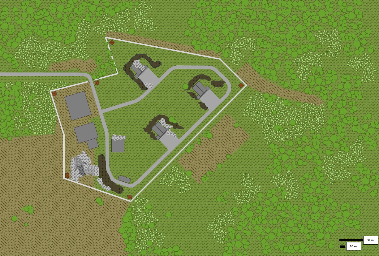
Map is grid-less, but provides you a scale in the bottom right corner. I tried and superimpose the hexagonal grid layer, but the base is so large that in order to make use of the grid you have to zoom-in considerably, and the resolution of the image doesn’t really hold up to that (I had no plan for sharing the map when I made it…)
Still, I think it’s perfectly usable for a chapter of your adventure in the WWIII that never was.